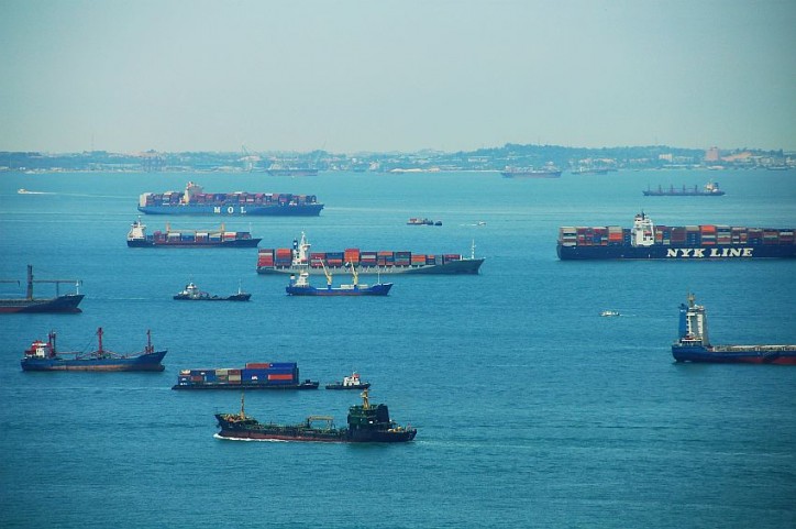
 The Civil Aviation Authority of Singapore (CAAS) and Maritime and Port Authority of Singapore (MPA) have invested in a new Medium-altitude Earth Orbit Search and Rescue (MEOSAR) ground system to enhance search and rescue capabilities in Singapore’s maritime and aeronautical Search and Rescue Regions (SRRs).
The system comprises a ground segment as well as a space segment which deploys Medium-altitude Earth Orbit (MEO) satellites. Distress signals, emitted from the emergency beacons activated by aircraft, ships or persons in distress, will be received simultaneously by the MEO satellites and relayed back to the ground segment.
The new MEOSAR ground system is an improvement to the current Low-altitude Earth Orbit Search and Rescue (LEOSAR) ground system, with access to more satellites and employment of more advanced technologies to enhance position accuracy for faster detection and location of distress parties. Costing S$8.4 million, the MEOSAR ground system will be fully operational in 2018.
Mr Kevin Shum, Director-General of CAAS, said, “We are committed to ensuring that prompt assistance is available to persons in distress within the Singapore Search and Rescue Region. The acquisition of the improved space-based system will enhance our search and rescue capabilities. It will complement our equipment and resources to provide faster, more accurate and reliable data to locate persons in distress.”
Mr Andrew Tan, Chief Executive of MPA, added, “In any search and rescue mission, time is of the essence. The new MEOSAR system will allow us to detect and locate the distress party more accurately for the expeditious deployment of assets to save lives. This is in line with the MPA’s continuous efforts to adopt new technologies to enhance our search and rescue capabilities.”
The adoption of the MEOSAR ground system is an initiative under the Cospas-Sarsat programme, which is an international satellite-based programme that provides accurate, timely, and reliable distress alert and location data to help search and rescue authorities assist persons in distress. In line with our objective of saving lives, Singapore has been an active participant of the programme since 1991.
Annex A – Overview of Cospas-Sarsat System
Cospas-Sarsat Programme is an international, humanitarian, cooperative worldwide satellite-based Search and Rescue (SAR) alert programme for aviation, maritime as well as land users in distress. The Cospas-Sarsat system allows users in distress to use a battery powered electronic emergency beacon to alert SAR agencies of their situation. The beacon transmits emergency signals to the satellites, called the space segment, that detect and relay the beacon’s signals to the ground segment or the ground system. A typical overview of the Cospas-Sarsat system is shown in the figure below.
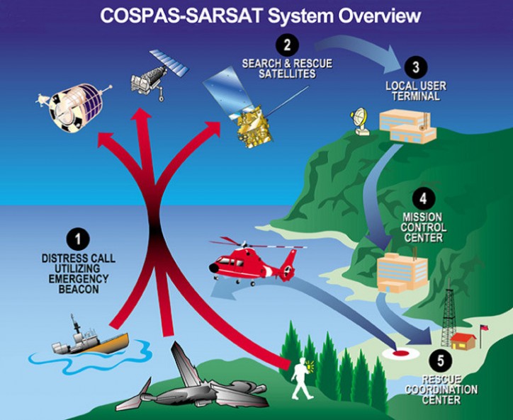
The ground segment consists of the Local User Terminal (LUT) and Mission Control Centre (MCC). The LUT is a ground receiving station that processes the satellite signals and sends the processed location of the distress signal and signal information to the MCCs. The MCC collects LUT data, sorts the information, and distributes the alert data to the appropriate land or sea Rescue Coordination Centres (RCCs), SAR Point-of-Contacts (SPOCs), or other MCCs. The RCC or SPOC dispatches SAR assets to the beacon location for SAR operation.
All MCCs are connected globally via communication networks for the sharing of information to facilitate responses to the distress signals. Singapore is responsible for the sending of emergency messages to SPOCs such as Brunei, Malaysia and Myanmar.
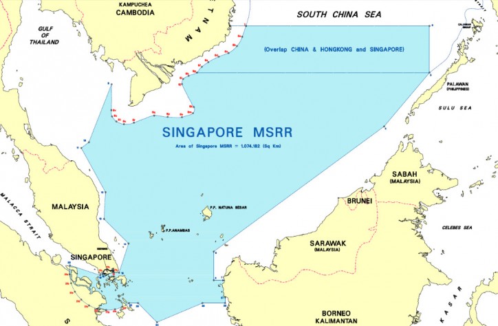
Annex B – Singapore’s Search and Rescue (SAR) Regions
The Maritime Search and Rescue Region (MSRR) tasked to MPA is as shown below.
The Aeronautical Search and Rescue Region (ASRR) tasked to CAAS coincides with the Singapore Flight Information Region (FIR), as shown below.

Source: MPA