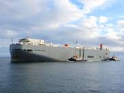
SOUTHERN HIGHWAY
Vehicles Carrier, IMO 9338632
The current position of SOUTHERN HIGHWAY is at East Australia reported 9 days ago by AIS. The vessel is en route to the port of Nansha, China, sailing at a speed of 17.3 knots and expected to arrive there on Apr 25, 07:00. The vessel SOUTHERN HIGHWAY (IMO 9338632, MMSI 431857000) is a Vehicles Carrier built in 2008 (16 years old) and currently sailing under the flag of Japan.

Position & Voyage Data
| Predicted ETA | |
| Distance / Time | |
| Course / Speed | |
| Current draught | 7.0 m |
| Navigation Status | - |
| Position received |
9 days ago
|
| IMO / MMSI | 9338632 / 431857000 |
| Callsign | 7KCN |
| Flag | Japan |
| Length / Beam | 188 / 28 m |
Map position & Weather
Recent Port Calls
Vessel Utilization
Vessel Particulars
| IMO number | 9338632 |
| Vessel Name | SOUTHERN HIGHWAY |
| Ship type | Vehicles Carrier |
| Flag | Japan |
| Homeport | |
| Gross Tonnage | 39065 |
| Summer Deadweight (t) | 12892 |
| Length Overall (m) | 188 |
| Beam (m) | 28 |
| Draught (m) | |
| Year of Build | 2008 |
| Builder | |
| Place of Build | |
| Yard |
| TEU | - |
| Crude Oil (bbl) | - |
| Gas (m3) | - |
| Grain | - |
| Bale | - |
| Classification Society | |
| Registered Owner | |
| Owner Address | |
| Owner Website | |
| Owner Email | |
| Manager | |
| Manager Address | |
| Manager Website | |
| Manager Email |
History
| Vessel Name | Registered Owner | Year |
|---|---|---|
| SOUTHERN HIGHWAY | 2008 |
Similar vessels
| Vessel | Built | GT | DWT | Size (m) |
|---|---|---|---|---|
 SILVER SUN Vehicles Carrier |
1988 | 39187 | 9772 | 183 / 30 |
 VIKING AMBER Vehicles Carrier |
2010 | 39362 | 12471 | 167 / 28 |
 VIKING CORAL Vehicles Carrier |
2011 | 39362 | 12588 | 167 / 28 |
 VIKING DIAMOND Vehicles Carrier |
2011 | 39362 | 12572 | 167 / 28 |
 EASTERN HIGHWAY Vehicles Carrier |
2006 | 39422 | 12991 | 188 / 28 |
 WESTERN HIGHWAY Vehicles Carrier |
2007 | 39422 | 12980 | 188 / 28 |
 NORTHERN HIGHWAY Vehicles Carrier |
2009 | 39422 | 12856 | 188 / 28 |
 GRANDE COLONIA Vehicles Carrier |
2007 | 38671 | 12292 | 176 / 31 |
 VIKING EMERALD Vehicles Carrier |
2012 | 39454 | 12459 | 167 / 28 |
 VIKING SEA Vehicles Carrier |
2012 | 39454 | 12550 | 167 / 28 |
Disclaimer
SOUTHERN HIGHWAY current position and history of port calls are received by AIS. Technical specifications, tonnages and management details are derived from VesselFinder database. The data is for informational purposes only and VesselFinder is not responsible for the accuracy and reliability of SOUTHERN HIGHWAY data.