| Satellite Coverage |
| Terrestrial Coverage |
| No Ads |
| Advanced Vessel Filters |
| Past Track Duration |
| Port Calls |
| Route Planner |
| My Fleet |
| Fleet Explorer |
| Fleet Sharing |
| Vessel Particulars |
| Build & Engine Details |
| Owner & Manager Contacts |
| Vessel Utilization |
| Satellite map |
| Nautical charts |
| Traffic Density Map |
| Advanced Port Filters |
| Terminal & Berth Arrivals |
| ETA Prediction |
| Container Tracking |

|
Satellite Coverage
|
|
Terrestrial Coverage
|
|
No Ads
|
|
Advanced Vessel Filters
|
|
90 days
Past Track Duration
|
|
15
Port Calls
|
|
Unlimited
Route Planner
|
|
2000 ships
My Fleet
|
|
Fleet Explorer
|
|
Fleet Sharing
|
|
Vessel Particulars
|
|
Build & Engine Details
|
|
Owner & Manager Contacts
|
|
Vessel Utilization
|
|
Satellite map
|
|
Nautical charts
|
|
Traffic Density Map
|
|
Advanced Port Filters
|
|
Terminal & Berth Arrivals
|
|
ETA Prediction
|
|
5 per month
Container Tracking (5 per month)
|
PREMIUM

|
Satellite Coverage
|
|
Terrestrial Coverage
|
|
No Ads
|
|
Advanced Vessel Filters
|
|
7 days
Past Track Duration
|
|
5
Port Calls
|
|
500
Route Planner
|
|
500 ships
My Fleet
|
|
Fleet Explorer
|
|
Fleet Sharing
|
|
Vessel Particulars
|
|
Build & Engine Details
|
|
Owner & Manager Contacts
|
|
Vessel Utilization
|
|
Satellite map
|
|
Nautical charts
|
|
Traffic Density Map
|
|
Advanced Port Filters
|
|
Terminal & Berth Arrivals
|
|
ETA Prediction
|
|
Container Tracking
|
BASIC

|
Satellite Coverage
|
|
Terrestrial Coverage
|
|
No Ads
|
|
Advanced Vessel Filters
|
|
3 days
Past Track Duration
|
|
1
Port Calls
|
|
100
Route Planner
|
|
20 ships
My Fleet
|
|
Fleet Explorer
|
|
Fleet Sharing
|
|
Vessel Particulars
|
|
Build & Engine Details
|
|
Owner & Manager Contacts
|
|
Vessel Utilization
|
|
Satellite map
|
|
Nautical charts
|
|
Traffic Density Map
|
|
Advanced Port Filters
|
|
Terminal & Berth Arrivals
|
|
ETA Prediction
|
|
Container Tracking
|
FREE

Free
|
Satellite Coverage
|
|
Terrestrial Coverage
|
|
No Ads
|
|
Advanced Vessel Filters
|
|
1 day
Past Track Duration
|
|
1
Port Calls
|
|
100
Route Planner
|
|
10 ships
My Fleet
|
|
Fleet Explorer
|
|
Fleet Sharing
|
|
Vessel Particulars
|
|
Build & Engine Details
|
|
Owner & Manager Contacts
|
|
Vessel Utilization
|
|
Satellite map
|
|
Nautical charts
|
|
Traffic Density Map
|
|
Advanced Port Filters
|
|
Terminal & Berth Arrivals
|
|
ETA Prediction
|
|
Container Tracking
|
Prices do not include VAT
Frequently Asked Questions
-
What payment methods are accepted?We accept bank transfers, as well as online payments via credit/debit card. If you prefer to pay by bank transfer, please contact us for detailed instructions.
-
Will I receive an invoice after making an online payment?Yes, an electronic invoice will be issued upon successful payment. Please ensure your company details are correctly entered to prevent additional VAT charges.
-
When will my service be activated?Your service will be activated automatically once the payment is processed – typically within a few minutes.
-
Is customer support available for subscribers?Yes, subscribers have access to dedicated customer support. You can reach out to our support team using our contact form.
-
Does the subscription renew automatically?No, subscriptions do not renew automatically. However, you will receive a reminder notification on the website one week before your service expires.
-
Is there a limit on how many users can access one subscription account?Subscriptions are intended for individual use. If you require multi-user access for a team or organization, please contact support to discuss enterprise solutions.
-
Can I upgrade or downgrade my subscription plan?Yes, you can change your subscription plan at any time. Please contact our support team for assistance with upgrading or downgrading your plan.
-
Is there a mobile app available?A free mobile app is available for Android devices. For iOS users, a paid version is available, or you can access the service through your mobile browser at no additional cost.
-
Do the Premium or Satellite plans include access to API or historical data services?No, API access and historical data are not included in these plans and are available as separate commercial services.
-
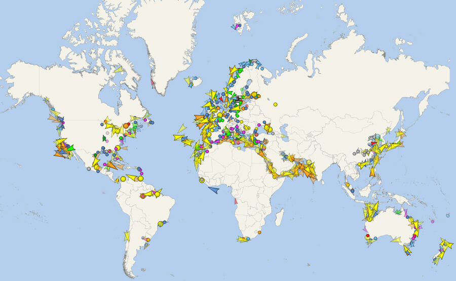
Can I monitor vessels that are out of terrestrial range with a Premium subscription?No, Premium users can only track vessels within range of terrestrial AIS stations. For offshore or global tracking, the Satellite subscription is recommended.
-
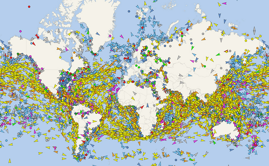
How does the Satellite subscription differ from the Premium subscription?The Premium subscription includes access to real-time vessel tracking based on terrestrial AIS coverage only. In contrast, the Satellite subscription offers global vessel tracking through both terrestrial and satellite AIS data, enabling real-time visibility even in open sea areas. Additionally, the Satellite plan includes extended features such as a 90-day track history, monitoring of up to 2,000 ships in 'My Fleet', extended number of port calls, and advanced tools like vessel filters and utilization insights.