Introducing ICT-based Ship Operation Tool, Targeting Sea Routes around the World
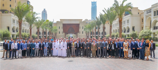
TOKYO-Mitsui O.S.K. Lines, Ltd. (MOL) announced that, along with Furuno Electric Co., Ltd., it made a joint presentation of their advanced augmented reality (AR)-based Navigation System to about 200 tanker industry representatives at the ENOC Marine Conference and OCIMF Middle East Regional Marine Forum (Note 1) held in Dubai in September.

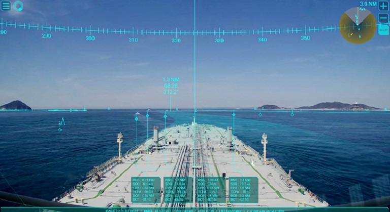
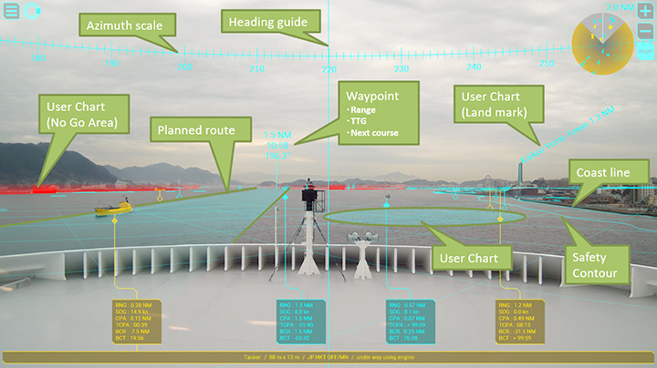
The presentation introduced the background behind the technology and development of the system, as well as MOL’s efforts to "forge ahead to become the world leader in safe operation." The AR Navigation System provides visual support to crewmembers during their watch-keeping and ship operations by using AR technology to superimpose real-time video imagery and voyage information (Note 2).

Large tankers, which have a deep draft*, require very careful ship operations in waters such as the Strait of Malacca, a highly congested shipping lane. If a collision or grounding occurred, it could lead to an oil spill and serious environmental disaster.
* The vertical distance between the bottom of the hull and the waterline.

AR Navigation System can display combined real-time video images and vehicle course information from nautical instruments on a display in the bridge even in congested sea lanes. Since it allows mariners, at a glance, to ensure that they are on a safe course, alerts them to nearby vessels that could pose a risk, shallow sea areas, and other potential hazards. The presentation gained considerable interest among tanker industry representatives in attendance at the conference. Using feedback gained at the conference, MOL will continue to work closely with FURUNO to study further upgrades to the system, with the goal of ensuring that the AR Navigation System will contribute to marine traffic safety through "the eyes of the captains and officers" who actually use the system onboard, and offer encouraging support to users.
Note 1 - ENOC Marine Conference and OCIMF Middle East Regional Marine Forum. It was held in the U.A.E. from September 10-11, 2019, by Emirates National Oil Company of the U.A.E. (ENOC) and the Oil Company International Marine Forum (OCIMF).
Note 2 - The system displays information on other vessels sailing on a vessel's planned route and surrounding sea areas and other ocean conditions, such as shallow waters, on tablets and screens. It integrates information from the Automatic Identification System (AIS) and radar (TT) with real-time video images from the bridge camera in collaboration with FURUNO's cutting-edge Electric Chart Display and Information System (ECDIS) FMD3300 series.
Source: MOL