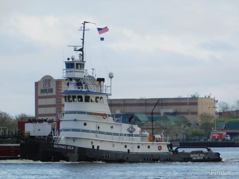
The current position of BERING SEA is
at US East Coast reported 35 hours ago by AIS.
The vessel BERING SEA (IMO 7512064, MMSI 366920250) is a Pusher Tug built in 1975 (50 years old) and
currently sailing under the flag of United States (USA).
Voyage Data
Destination
Destination not available
ETA: -
| Predicted ETA | - |
| Distance / Time | - |
| Course / Speed | |
| Current draught | 5.5 m |
| Navigation Status |
- |
| Position received |
|
| IMO / MMSI | 7512064 / 366920250 |
| Callsign | WDH2994 |
| AIS Type | Tug |
| AIS Flag | United States (USA) |
| Length / Beam | 63 / 28 m |
Vessel Particulars
| IMO number | 7512064 |
| Vessel Name | BERING SEA |
| Ship Type | Pusher Tug |
| Flag | United States of America |
| Year of Build | 1975 |
| Length Overall (m) | 30.55 |
| Length BP (m) | |
| Beam (m) | 8.84 |
| Draught (m) | |
| Depth (m) | |
| Gross Tonnage | 292 |
| Net Tonnage | |
| Deadweight (t) | - |
| TEU | - |
| Crude Oil (bbl) | - |
| Gas (m3) | - |
| Grain (m3) | - |
| Bale (m3) | - |
| Ballast Water (m3) | - |
| Fresh Water (m3) | - |
| Builder | |
| Place of Build | |
| Hull | |
| Material | |
| Engine Builder | |
| Engine Type | |
| Engine Power (kW) | |
| Fuel Type | |
| Service Speed (kn) | |
| Propeller | |
Management
| P&I Club | - |
| Classification Society | |
| Last Survey | - |
| Next Survey | - |
Disclaimer
BERING SEA current position and history of port calls are received by AIS. Technical specifications, tonnages and management details are derived from VesselFinder database. The data is for informational purposes only and VesselFinder is not responsible for the accuracy and reliability of BERING SEA data.